
Mouza map Preparation
The mauza maps have been digitized through On-screen Digitization process using ArcGIS software. All the features of a mauza map such as Plot boundary, Plot number, Road, Canal, Building, Mosque, Temple, Traverse Station, Iron Pillar, etc., are created and stored with attributes in four different vector layers as per the Technical Specification of GIS Database.
Topographic survey
RTK and Total Station (TS) based advanced survey techniques were used for conducting Topographic survey in the project area. To measure the spot levels (Northing, Easting, Elevation or RL) for contour generation of the project area.
Existing Landuse Survey Data
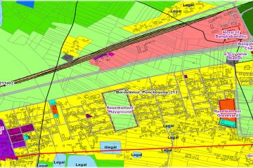
Utilizing the land use and physical feature base map were prepared at specified scale based on the data collected through land use survey and the information of the base map. The characteristics of each land use area have fully been described in the survey report.
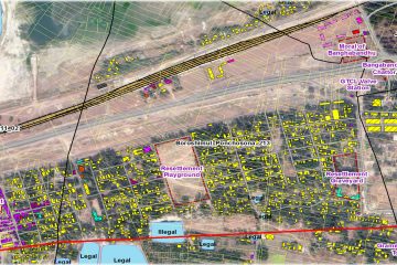
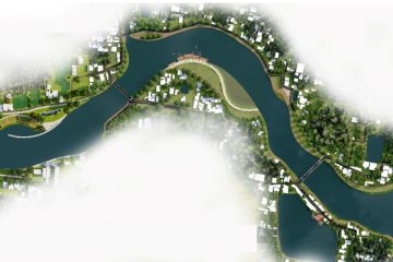
Landuse Plan
Landuse Plan makes proposals on urban promotion within the project area and identifying long-term development options and selecting development projects for implementation in the short term.
Base Map Preparation
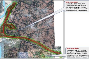
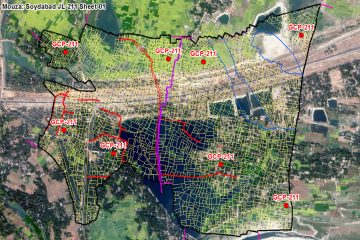
A suitable number of GCP (minimum 4), preferably plot corners and building corners, has been taken for proper geo-referencing of mauza map
Spatio-Temporal Analysis
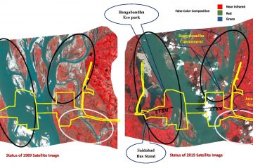
Comparative Analysis from Landsat Image classification, it has been observed that the total amount of accretion which is erosional area is 2.5 km and 2.1 km area has eroded in the last 30 years. As a result, Bangabandhu Cantonment and Jamuna Resort is going to face erosional risk in near future.
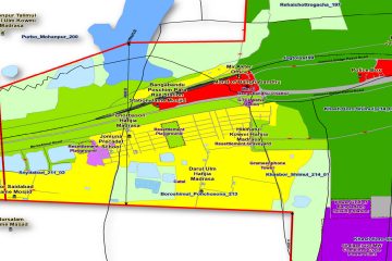
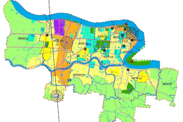
Structure Plan
In Sirajginj district, the captivating zone is water body which covers 45% of total land same as tangail district. Eco park which is very catchy location for the people covers 573.46 acres of land. Among all zones, Agricultural zone is also prominent covering 15% of total land. Others major zones are Rural settlement, open space and circulation network covering 10%, 6% and 3% respectively.
Investment Plan
It is basically a local level planning exercise and enrolled at 5 years interval. It also contains description of the proposed sequence and related activities for the implementation. Investment Plan details out development proposals under the frame work of Structure plan.
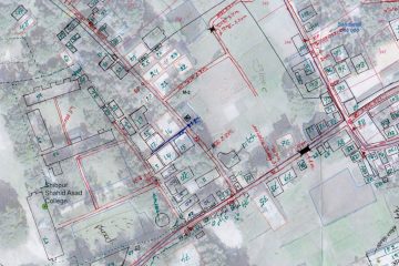
Physical Feature Survey
The survey team has collected following information from field: Position, dimension, type, number of stories of all structures according to their use (Residential, Commercial, Industrial, Mixed use, etc.) Lease information, owner/authority name also collected in this survey.
Physical Feature Survey Data
After completion of field survey, all type of spatial data is properly processed to obtain layers of physical features such as Structures, Roads, Water bodies, etc. All surveyed sheets are scanned and geo-referenced to superimpose on the satellite imagery. The surveyed features (structures, roads, water bodies, etc.) marked on the sheets were then digitized using the ArcGIS software and stored them layer by layer as per Technical Specifications on GIS Database.
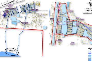
Drainage Plan
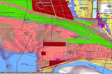
Drainage network are proposed along the Approach road to Gabindasi located at Resettlement zone of Tangail district. The Out-flow direction of the drainage is towards the canal which is situated along the Polshia Jame Masjid in Tangail district.
The approach road which is Dhaka-Rajshahi Highway is much elevated whereas the alongside area is comparatively low lying which creates water logging inside the project area. To reduce the problem a drainage outflow has been proposed connecting resettlement area of Sirajganj which is situated near Bangabandhu Poshim Para Rail Station and ends in a portion of Brahmaputra river near Soydabad area.
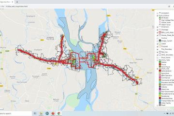
Web GIS Map
By utilizing the Internet to access information over the web without regard to how far apart the server and client might be from each other, web GIS introduces distinct advantages over traditional desktop GIS, including the following: 1. A global reach, 2. A large number of users, 3. Better cross platform capability, 4. Low cost as averaged by the number of users, 5. Easy to use, 6. Unified updates

Structure Area Plan
The Structure plan is the higher - level plan, which comprises of strategic decisions for overall physical development of the Patuakhali Paurashava for the next 20 year.
Urban Area Plan
The Urban Area Plan provides a detail guideline for managing and promoting development in the urban areas of Patuakhali Paurashava on the basis of the strategies set by the longer - term structure plan.
Action Area Plan
The action area plan is a planning document that covers four successive five-year periods of a structured plan of 20 years time frame. It deals with projects related to land development.